
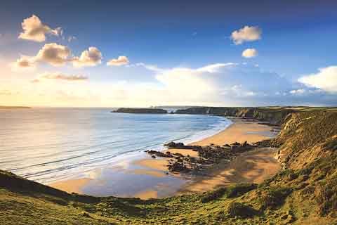
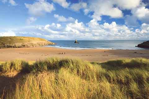
Chris Warren, a professional photographer, shared with Tenby and District Arts Club the 60 images of the Pembrokeshire Coast National Park that he took for a commission to mark 60 years of the Park (writes A.D.). The 243 sq. miles Park was created in 1952, with the Coast Path following in 1970.
The images were intended to show both the landscape and uses of the land; and to be a baseline for recording changes in the Park in the future. Chris had to take the photos from October to December, so had to take into account the daylight hours, tides, weather and mileage. With recce shots and attempts to get the right weather, Chris did 3,000 miles carrying out this commission.
The presentation started on the eastern side of the southern coast of Pembrokeshire with Amroth, showing the tramways coming to the coast from the mines, an early morning shot of Wiseman's Bridge; and the harbour in Saundersfoot built in 1829 and with five jetties in 1837. The shot of Tenby was of the harbour from the Croft, and at Lydstep showed views to Caldey Island. Manorbier was shown looking back from the King's Quoit Cromlech towards the Castle.
The central portion of the west coast showed Freshwater East, and Greenala, with interesting geology and evidence of hill forts. Barafundle in the sunrise, and Bosherston Lilyponds looking towards the arched bridge; Broadhaven South, the 13th century St. Govan's Chapel and the limestone arch of the Green Bridge of Wales.



The west portion of the south coast started at Frainslake Mill, which is on MOD land and has been flooded so the mill is submerged and only accessible when the MOD have guided walks. Freshwater West, Angle Bay and Thorn Island followed, and then inland to Carew Castle looking down towards the mill, a shot looking down onto Cresswell Quay, sunrise on Cresswell river near Lawrenny, Garron Pill, Minwear, Picton Point and a misty view of a yacht at Llangwm.
Over to the north coast of Pembrokeshire, the next photograph was looking out to the West Blockhouse, built in 1854 of limestone to accommodate 40 soldiers and six 68-pound guns. The shot of Dale showed the jetty with sailing boats looking across to the oil refinery. The journey continued with Warwick Bay, Marloes Sands, Gateholm Island, showing the deer park, and Skomer Island, and the rock formations at St. Brides.
Haroldston Chins, near Druidston, was represented with a view towards Newgale, then Newgale itself, Porthmynawyd beach, Solva in the early morning looking down on the harbour, and Caerbwydy Bay. From the 1934 chapel at St. Nons, the most westerly in Wales, to St. David's Cathedral (a difficult shot as St. David's is four metres different in height from east to west!), and along the coast past, Treginnis, Penllechwen, Penberi, Abereiddi, Porthgain, Penbwchdy, Strumble Head, and Llanwnda.
In the north, highlights were the Coast Park's only waterfall at a secluded cove in Aberfforest, the Witches Cauldron (a large collapsed cave, accessible by kayak), Portfaen woods in the Gwaun Calley, the Nevern Cross and Castell Henllys, a replica Iron Age hill fort built on top of the remains of an original one.
The presentation included familiar and unfamiliar places in the Coast Park, all stunning images often from unusual angles, and the evening at the Arts Club flew by.
This week (October 24), the Arts Club is pleased to present the AMA Trio, presenting a selection of early music for three voices, starting as usual at 7.30 pm at St. Johns Church Hall, Tenby. Entrance is £2 members, or £4 non-members, including refreshments afterwards. Everyone is welcome.
Comments
This article has no comments yet. Be the first to leave a comment.