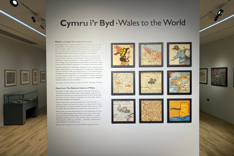
Wales to the World Exhibition at Haverfordwest Riverside Library makes for an interesting journey into the world of maps.
The collection of maps from the National Library of Wales currently on display in the Riverside Library gallery, Haverfordwest includes the earliest printed map specifically of Wales, a Cold War map of Pembroke Dock secretly drawn by the Soviet Union, and a maritime chart of Tenby.
Brand-new artworks inspired by the map collection are also on display for the first time in this exhibition, alongside the items that inspired them.
A clockwise route around the exhibition, starting on the left, is recommended for a chronological exploration of the cartography of Wales and the improvements in accuracy. The oldest maps are fascinating for local place names spelt differently, like ‘Nangle’ and ‘Penbrooke’, and the absence of now major towns.


The new exhibition covers the development of Wales on the map, maps as tools of learning and play, and the power of maps to persuade and mislead us. The exhibition was created by Ellie King, Assistant Map Curator at the National Library of Wales. Ellie is a newly qualified librarian and has been mentored by the exhibitions team as part of the National Library’s commitment to providing learning and development opportunities for staff.
To coincide with this exhibition, a programme of events and education workshops will take place at the Riverside Gallery. The first of these is a conversation session between the artists Mfikela Jean Samuel and Jasmine Violet and Ellie King on October 19 at 5pm.
Showing alongside the Wales to the World exhibition is the permanent exhibition Pembrokeshire: Past and Present, focusing on the history, culture and landscape of Pembrokeshire. Both exhibitions will run until Saturday, February 24, 2024.
Comments
This article has no comments yet. Be the first to leave a comment.