As Storm Kathleen passes causing relatively little disruption, it appears Storm Lilian is just around the corner, with more wet and windy weather forecast for Pembrokeshire and West Wales this week.
The Met Office has a warning in place from 1am to 3pm for Tuesday, April 9, with strong winds of up to 65mph predicted, that are likley to bring hazardous coastal conditions to parts of Pembrokeshire and Carmarthenshire, and could cause some travel disruption.

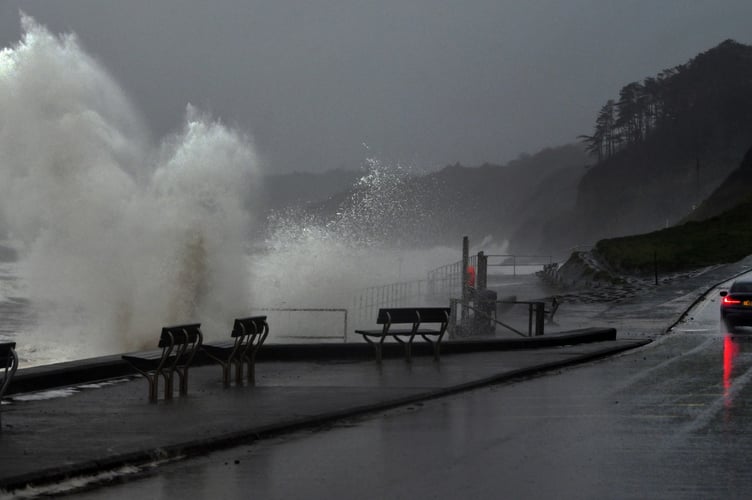
The Met Office states that it’s likely that some coastal routes and sea fronts will be affected by spray and large waves.


‘Storm Kathleen arrived on Saturday to match the record for most named storms in a season, marking a hyperactive season so far,’ - states website www.weatherandradar.co.uk
‘When Kathleen arrived in the UK and Ireland, it didn't just deliver strong gales across the countries but became just the second named storm ever beginning with the letter K.
‘Not since 2016 have we reached the letter K in a single storm season, Kathleen joins Storm Katie in the history books…for now.
‘During the 2022/23 storm season, we saw just two named storms, which both arrived during the final month of the season.

‘By comparison, this season, we are at 11 named storms with just under five months left until the season ends with the close of August.
‘When, or if, we do see another named storm in that time it will become Storm Lilian and officially mark the most active storm season on record for the UK and Ireland since the practice of naming storms began.’
Comments
This article has no comments yet. Be the first to leave a comment.