


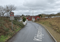
The Met Office has issued a yellow weather warning from this afternoon onwards, with strong winds and heavy rain expected, especially in coastal areas of Pembrokeshire and Carmarthenshire.
After a largely fine and dry Easter weekend for most, things will turn more unsettled today (Tuesday, April 11), with wind warnings in force from 3 pm onwards, bringing potential for some disruption, carrying on into the early hours of Wednesday.
The warnings highlight potential travel disruption and the possibility of large waves in coastal areas in the south and west.
It’s likely that some coastal routes, sea fronts and coastal communities will be affected by spray and/or large waves.


A developing low-pressure system looks likely to bring a more sustained period of wet and windy weather from Tuesday and into Wednesday, which has resulted in the issue of yellow wind warnings.
Met Office Deputy Chief Meteorologist Steven Keates said: “The focus for the medium-range forecast is a low-pressure system that’s likely to develop just to the southwest of the UK, potentially bringing a period of high winds and heavy rain late on Tuesday and into Wednesday.
“There’s a distinct possibility of some disruptive wind for parts of the UK, especially in southern and western areas, as well as potential for heavy rainfall and even some snow, though the latter probably confined to high ground in the north.
“Although subject to a large degree of uncertainty, gusts of wind could be in excess of 60 mph in some exposed upland or coastal regions, with around 35-50 mm of rain possible for some areas.”
That low pressure is likely to gradually move into the North Sea late through Thursday, though there are signals for some further rain to come later in the week.
Comments
This article has no comments yet. Be the first to leave a comment.