
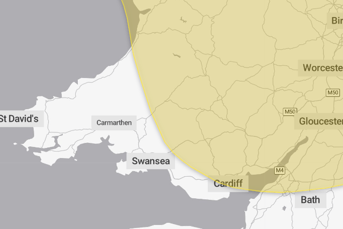
Many areas will see further warm and dry weather on Tuesday, with temperatures widely reaching the mid to high 20s Celsius across England and Wales. However, isolated showers and thunderstorms across southwestern parts are expected to become more widespread and develop across England and Wales from Tuesday evening and overnight into Wednesday. This brings the potential for longer spells of rain and heavy, sometimes intense downpours, frequent lightning and localised disruption.
On Thursday, widespread slow-moving heavy and thundery rain is expected to spread north across the UK, bringing the potential for prolonged periods of rainfall in some areas, including Carmarthenshire and Ceredigion. These areas could therefore see significant rainfall totals over several hours, increasing the likelihood of localised impacts from heavy rain and thunderstorms.
Met Office Chief Forecaster Steve Willington said: “As we move into Wednesday there is a growing risk of heavy rain and thunderstorms, with warm and humid air helping to trigger heavy showers and thunderstorms. Some places could see significant amounts of rain falling in a short period of time, bringing the potential for localised flooding, travel disruption and frequent lightning.
“On Thursday, slow-moving heavy and thundery rain may bring prolonged rainfall to some areas, increasing the risk of localised impacts. There remains some uncertainty around where the heaviest rain will fall, so it is important to keep up to date with the latest forecast and warnings"
Unsettled conditions may continue into Friday and the weekend, with further showers or longer spells of rain remain possible at times, alongside some drier and brighter periods.




Keep up to date with weather warnings, and you can find the latest forecast on the Met Office website, on YouTube, by following Met Office on social media or downloading the app.
Comments
We've recently changed our login process. If you have an account for commenting, you will need to re-register on the login window.
This article has no comments yet. Be the first to leave a comment.