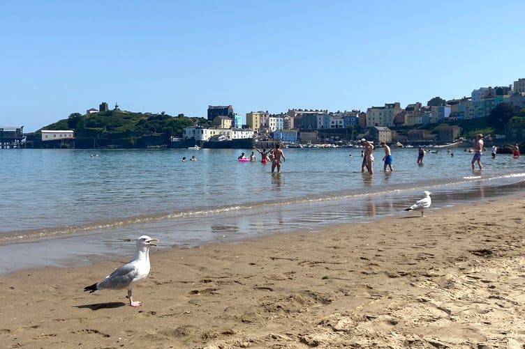
Temperatures are set to continue to soar on Thursday across Pembrokeshire and Carmarthenshire.
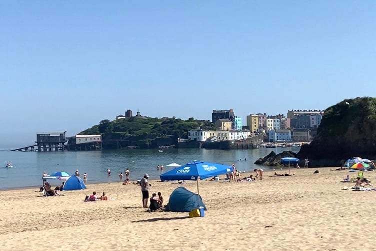
With all secondary schools closed across Carmarthenshire, and a number of primary schools taking the decision to close as well, due to extreme heat today and tomorrow (24 and 25 June), Carmarthenshire County Council is urging young people, parents residents and visitors to take extra care around rivers, lakes, reservoirs, beaches and other open water locations.
The Met Office Extreme Heat warning has been active for much of southern and central England and Wales across Wednesday (June 24) and will again on Thursday, with Amber warnings now also extending into Friday and Saturday for some.
The Red warning came into force at 9am on Wednesday morning and will now last through to late on Thursday night.


This is embedded within a wider Amber warning area, which covers much of England and Wales through Wednesday and Thursday.
Met Office Chief Forecaster Matthew Lehnert said: “This is exceptional heat for June with temperature records expected to be broken this week. Red warnings are reserved for the most severe events and we’re expecting significant impacts from this heatwave, with health issues likely, even beyond those who are more vulnerable to the heat.
“High humidity is an additional factor for this heatwave which will mean the heat will feel much more potent for many. When you couple all of this with the high overnight temperatures, with temperatures likely to stay above 20°C for large parts of England and Wales, these combined impacts all increase the potential for significant impacts.”

Temperatures will exceed 30°C for many on Thursday, with a peak of around 38°C possible on Thursday and Friday, though there’s still a chance of this being exceeded.
The existing UK June daily air temperature record of 35.6°C, reached on 28 June 1976 and 29 June 1957, is very likely to be exceeded in the coming days.
Overnight highest minimum temperature records for June are also at risk in the coming days, with Wales already provisionally seeing its overnight temperature on record for the month, with 20.3°C the lowest figure reached at St Athan, South Glamorgan on Monday night.
Stay safe in heat
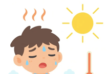
The combination of heat and humidity will be oppressive and bring impacts across society from public health and infrastructure, to power and water supplies.
The UK Health Security Agency has also issued a series of Heat Health Alerts, which specifically highlight the potential health and social care impacts.
Dr Agostinho Sousa, Head of Extreme Events and Health Protection at UKHSA said: “Very hot weather is forecast across large parts of England in the coming days and we are urging health and social care services across the country to ensure they are prepared. It is vitally important that people understand the risk posed by high temperatures like these, and take steps to keep themselves and their friends, families and neighbours safe.
“A red heat health alert indicates a risk to life for even the healthy population, but simple actions like staying hydrated, avoiding the sun during the hottest part of the day, and keeping your home cool can make a big difference. It’s also important to look out for others, especially elderly relatives, neighbours, and those with underlying health conditions, to make sure they are aware of the forecast and following the necessary advice.”
Age UK Charity Director Caroline Abrahams said: "Red extreme heat weather warnings are rare so when the Met Office issues one we need to take it seriously, especially if you are an older person living with underlying health conditions like heart or lung problems that increase your risk of heat-related harm.
“We hope anyone in this position, and older people more generally, will take extra care over the next few days and follow the excellent advice the Met Office and ourselves at Age UK have published on how to stay well when the temperatures soar. We also call on the public at large to look out for older people around them, to help them safely navigate the next few days.
“There are lots of simple precautions that older people can take to stay safe, such as keeping in the shade, drinking plenty of water and confining activities like walking or shopping to early or late in the day, certainly outside the hottest hours between 11am and 3pm. Keeping your home as cool as possible by closing curtains and windows during the day and opening them at night will make a difference too.”
Staying safe in cold water
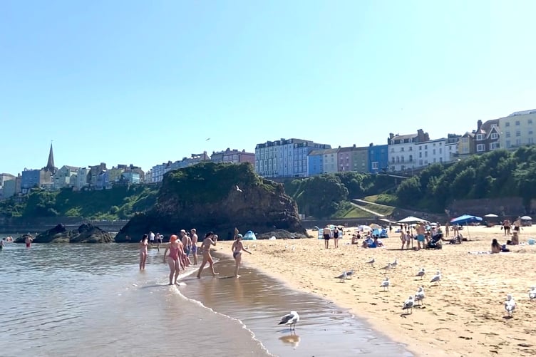
People heading to the coast should be mindful that sea-surface temperatures are not as high as they would be in mid-summer.
Samantha Hughes is the National Water Safety Partner at the RNLI. She said: “With warmer weather approaching, it’s important to remember that the water is still cold. Entering it unexpectedly can lead to cold water shock, causing a sudden increase in breathing and heart rate, which may trigger panic.
“If you find yourself struggling in the water, remember to Float to Live: tilt your head back so your ears are submerged, relax and control your breathing. You may need to gently use your hands to help you stay afloat, and it’s ok if your legs sink—everyone floats differently.
“Where possible, always choose a lifeguarded beach, and swim between the red and yellow flags. In a coastal emergency remember to call 999 for the coastguard.”
If you're planning on enjoying the water, here are three simple ways you can help keep yourself safer:
• Check the water temperature, our seas and river temperatures are low enough to cause cold water shock when 15°C or lower
• Wear a wetsuit if you plan on spending any length of time in the water
• Wearing a life jacket or swimming buoy can increase your chances if you experience cold water shock
Hot weather and climate change
The frequency and intensity of heatwaves has increased worldwide. Met Office projections indicate that hot spells will become more frequent in our future climate, particularly over the south-east of the UK. Temperatures are projected to rise in all seasons, but the heat would be most intense in summer.
It is virtually certain that human influence has increased the occurrence and intensity of extreme heat events. Numerous climate attribution studies have shown that human influence increased the chance that specific extreme heat events would occur, such as the summer of 2018 and July 2022.
Professor Stephen Belcher CBE, Met Office Chief Scientist, said: “The heatwave this week is a significant weather event, with a Red Extreme Heat warning issued. Human induced climate change has made events like this more likely and more intense.
"To see temperatures like this in the UK in June is sobering. Events like this bring home the implications of climate change, with very high temperatures and humidity bringing significant health implications from heat stress, as well as impacts to a range of sectors such as transport, energy and water supply.”
When will the heatwave end?
Thursday will see the peak of the heat for many, though those further east will retain extreme heat on Friday and Saturday and could continue to see further impacts, which has resulted in Amber warnings.
The far southeast will retain the warmth the longest, though there should be a climb-down in figures by Saturday, with peaks around 32°C likely.
Next week is likely to see a change to more of a westerly influence on the UK’s weather, with a return to more average temperatures for the time of year and a mixture of winds and rain, particularly for those in the northwest.
Comments
This article has no comments yet. Be the first to leave a comment.